Great Bitter Lake
Virtual asset linked to this landmark

- Virtual owner
- The platform
- Times sold
- 0
- Fame on Wikipedia
- 48,667 article reads in 12 months
- Searches (30 days)
- 0
- Watching
- 0
Virtual ownership only. It gives no legal, financial or physical right in the real landmark. Prices are set by the market and may fall.
About Great Bitter Lake and its history
A salt lake forming part of the Suez Canal between Ismailia and Suez, where ships were stranded from 1967 to 1975.
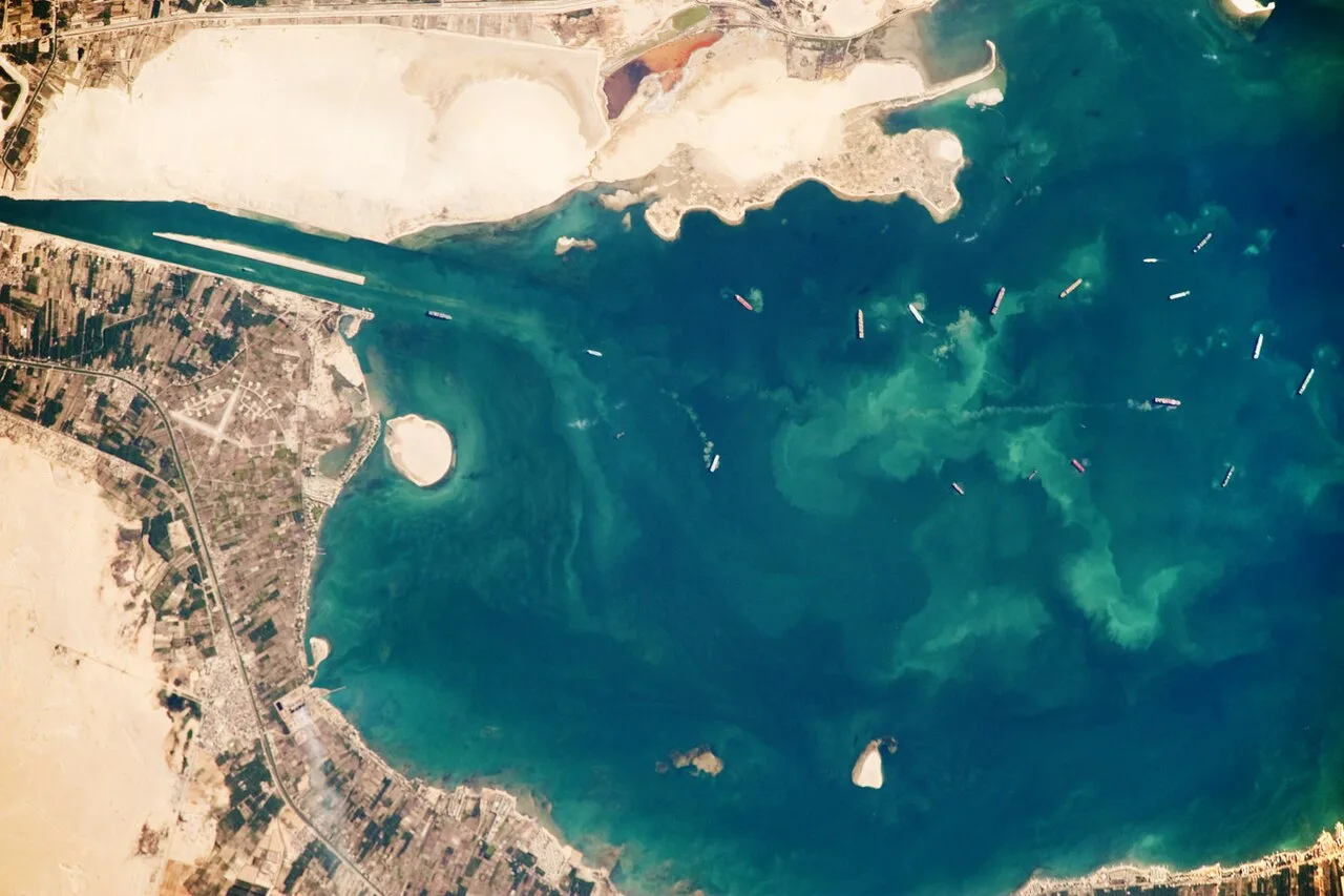
The Great Bitter Lake (Arabic: البحيرة المرة الكبرى; transliterated: al-Buḥayrah al-Murra al-Kubrā) is a large saltwater lake in Egypt which is part of the Suez Canal. Before the canal was built in 1869, the Great Bitter Lake was a dry salt valley or basin. References are made to the Great Bitter Lake in the ancient Pyramid Texts.
The canal connects the Great Bitter Lake to the Mediterranean Sea and the Red Sea. The canal also connects it to the Small Bitter Lake (Arabic: البحيرة المرة الصغرى; transliterated: al-Buhayrah al-Murra as-Sughra).
Ships traveling through the Suez Canal use the Great Bitter Lake as a "passing lane", where they can pass other ships or turn around.
Etymology
The Modern English and Arabic names are translations of the Greek name (Ancient Greek: Πικραὶ Λίμναι, lit. 'bitter lakes'). It was also known in Latin as "dead lake" (Latin: Lacus mori). The ancient Egyptian name for the Bitter Lakes region was km-wr, lit. "great black one".
Salinity
The salinity of the lake varies along its depth and is greatest at the bottom where the water is in contact with the preexisting salt deposit, which has been consistently diminishing due to dissolution—thereby steadily increasing the depth of the lake—since the canal started operation in 1869.
Salinity is subject to seasonal variation as a result of yearly evaporation cycles. In the early 20th century, the minimum and maximum values were measured as 4.5% and 5.4%, respectively, with an average salinity of 4.9% (i.e. 49 g of salt per kg of lake water).
When the Suez Canal was closed for eight years, beginning during the Six-Day War in 1967, the salinity of the lake increased substantially. In 2017 the minimum and maximum values measured at 4.1% and 4.5%, with an average close to 4.1%. For comparison, seawater averages 3.5%, while the Dead Sea is around 34%.
The salinity of the lake also depends on how much seawater flows into it from the Red and the Mediterranean Seas. Even when the canal is open, in certain places the Great Bitter Lake can have a salinity level "more than twice" the level of the sea. While this makes it difficult for plant life to exist there, many species (of crabs, for example) migrate from the Red Sea through the area.
As the canal has no locks, seawater flows freely into the lake from the Mediterranean and the Red Sea. In general, north of the lakes, the current reverses seasonally, being north-going in winter and south-going in summer. South of the lakes, the current is tidal, reversing with the tides in the Red Sea.
Fish and crabs can migrate, generally in a northerly direction, through the canal and lakes in what is known as a Lessepsian migration, as some Red Sea species have come to colonize the eastern Mediterranean.
Source: Wikipedia · text available under CC BY-SA 4.0
- Location
- Ismailia, Egypt
- Coordinates
- 30.3333, 32.3833
- Category
- Nature & Parks
Source: Wikipedia · Factual information about the real landmark; unrelated to virtual ownership.
Price & ownership history
Landmarks near Great Bitter Lake
Map → Available
📖 10 K reads
Available
📖 10 K reads
 Available
📖 68 K reads
Available
📖 68 K reads
 Available
📖 50 K reads
Available
📖 50 K reads