Zubaydah Trail
Virtual asset linked to this landmark

- Virtual owner
- The platform
- Times sold
- 0
- Searches (30 days)
- 0
- Watching
- 0
Virtual ownership only. It gives no legal, financial or physical right in the real landmark. Prices are set by the market and may fall.
About Zubaydah Trail and its history
A historic caravan road that linked Iraq with the Hejaz, dotted with reservoirs and wells.
The Zubaydah Trail, also known as the Al-Kufi pilgrimage route after Kufa, its starting point, is one among the seven major hajj pilgrimage routes in the Arabian Peninsula, dating back over 1000 years. A crucial trade route during the Abbasid era, it is a tentative candidate for the UNESCO World Heritage List. This historical trail was constructed to serve pilgrims from Iraq, neighbouring Islamic countries, and East Asian countries.
Its construction was completed during the Abbasid Caliphate, specifically between 132 AH (750 CE) and 656 AH (1258 CE).
The trail's history dates back to the pre-Islamic era, when it was used by tribes, travellers, and commercial caravans to move between Iraq and Western Arabia. Over time, its usage became regular and easier as the water centres, grazing areas, and mining locations along the route transformed into major stations.
During the Abbasid period, the trail served as an important link between Baghdad, the holy cities of Mecca and Medina, and the rest of the Arabian Peninsula. The Abbasid caliphs took great interest in the trail, enhanced it with various benefits and facilities, as well as undertook an expansion of the road to make it suitable for use by pilgrims, travellers, and their animals.
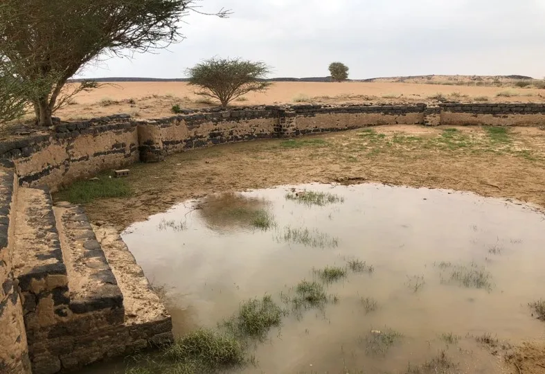
Historical, geographical, and archaeological sources show that the trail route was designed in a practical and meticulous manner. Along its length from Kufa to Mecca, stations, houses, and resting areas were established. Its surface was paved with stones in sandy and muddy areas. In addition, it was equipped with necessary amenities and facilities such as wells, ponds, and dams. Signages, lighthouses, beacons, and stoves were also set up to mark its path and guide travellers.
The Zubaydah Trail stretches over a distance of 1,300 kilometres and is connected to 27 main stations, most of which are concentrated in Saudi Arabia. Furthermore, 58 subsidiary stations called muta'asha, which are rest stops, were established between every two main stations. The average distance between each main station and the next is approximately 50 kilometres.
Source: Wikipedia · text available under CC BY-SA 4.0
- Location
- Northern Borders, Saudi Arabia
- Coordinates
- 29.0000, 43.5000
- Category
- Historic Landmarks
Source: Wikipedia · Factual information about the real landmark; unrelated to virtual ownership.